This week we revisited the site to measure both the interior and exterior (below).
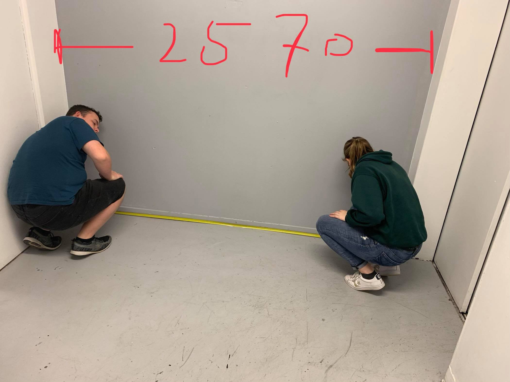
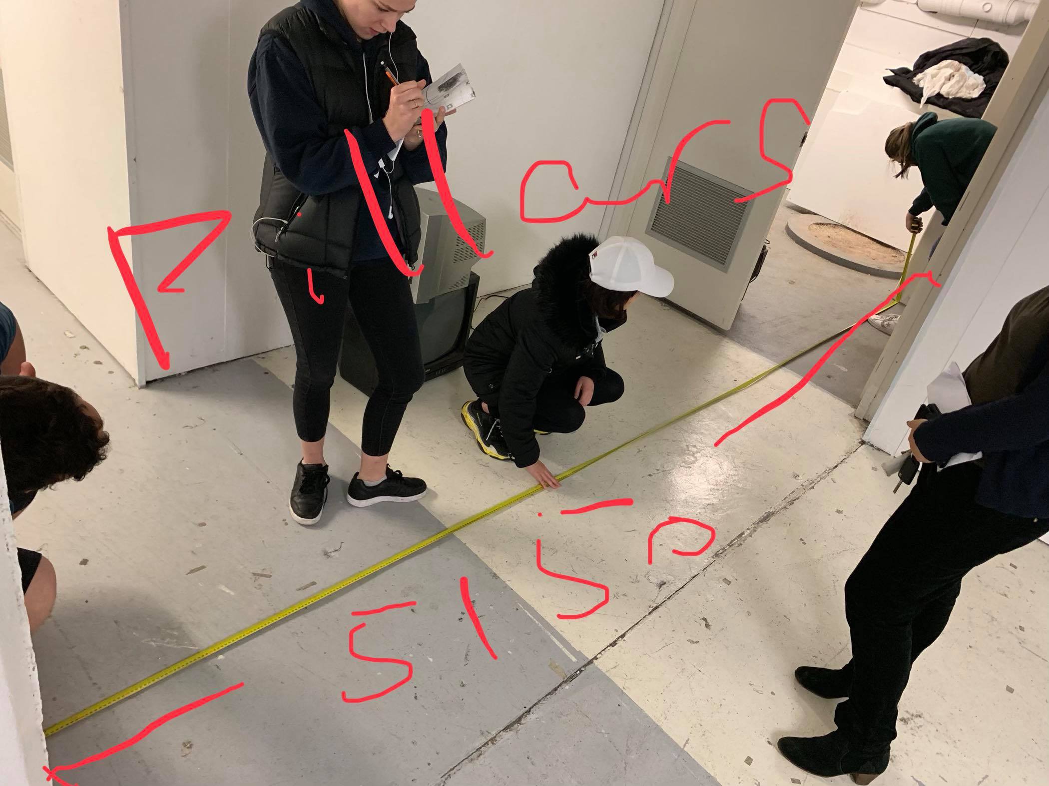
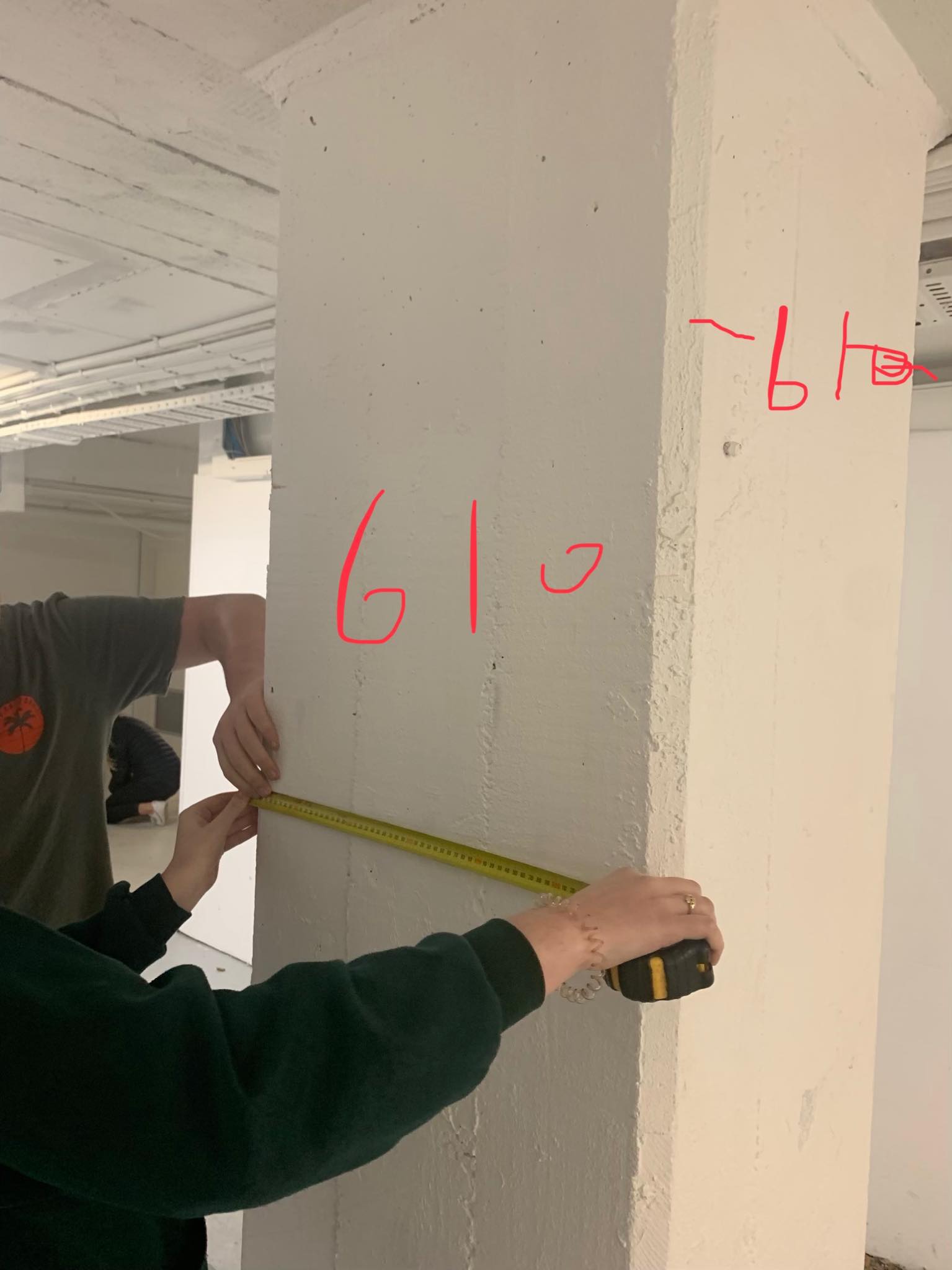
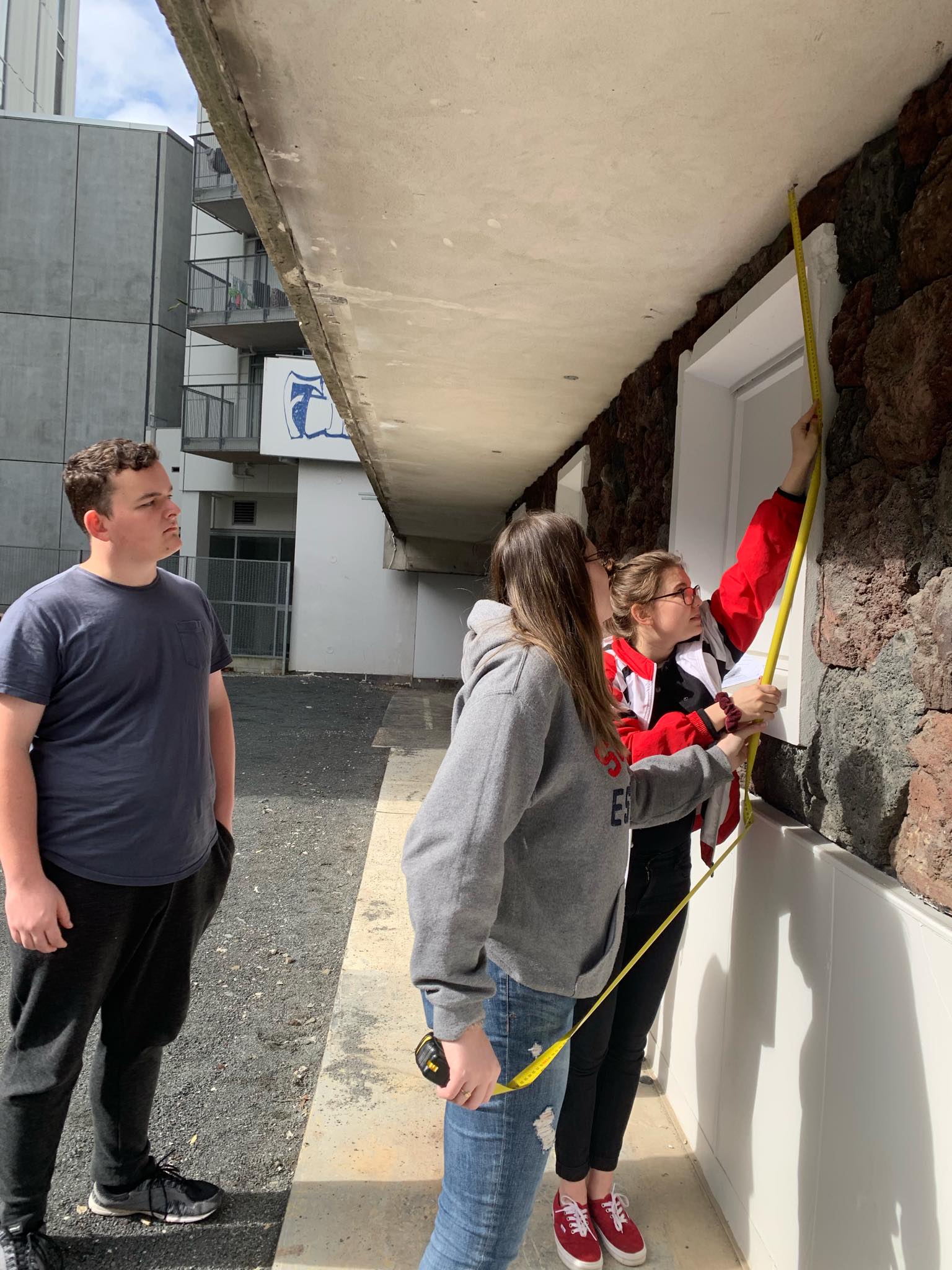
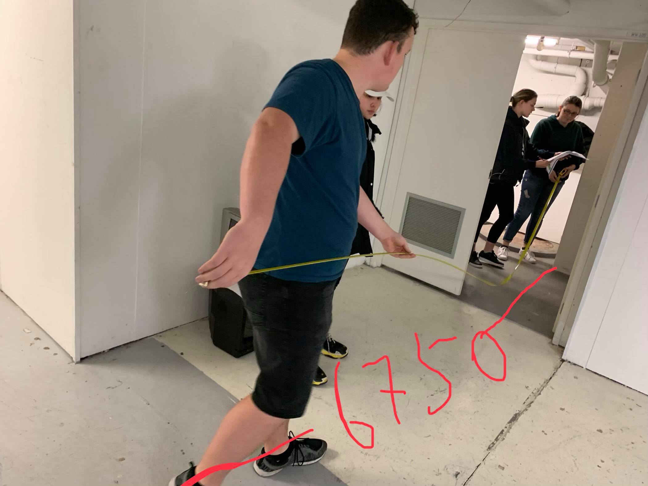
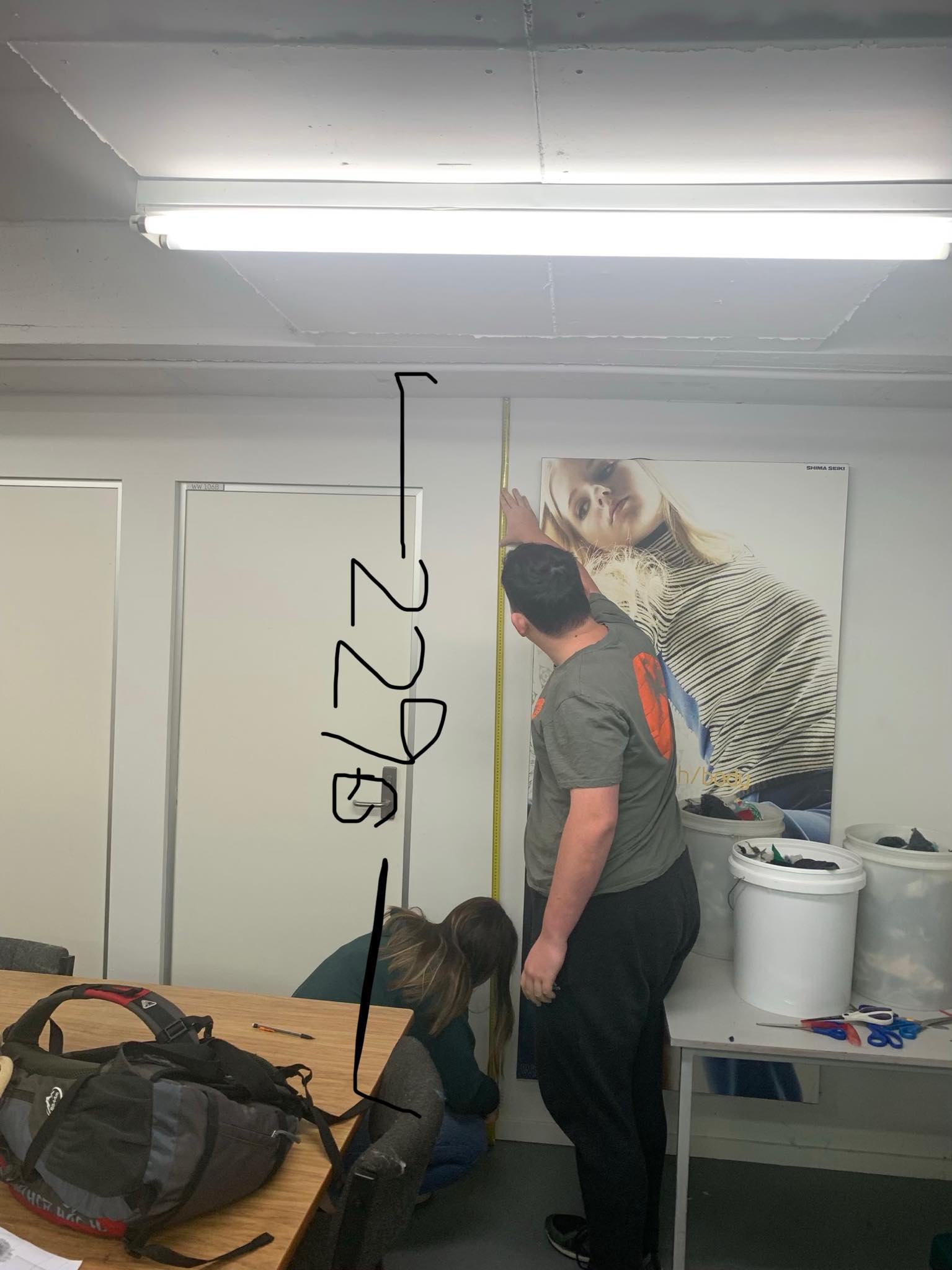
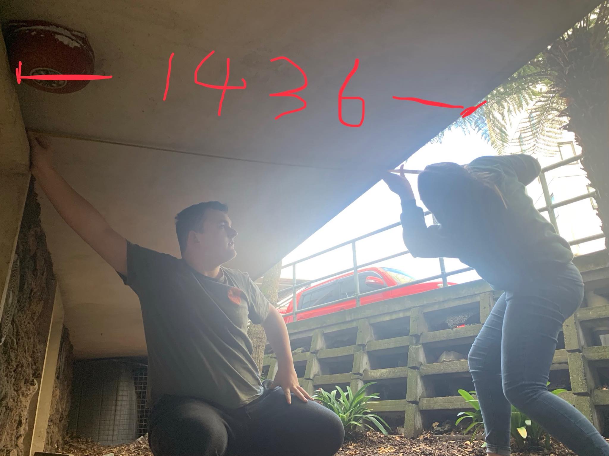
From here, we were able to record our measurements on our site plan. This is really important as we can now come back to the site plan as a reference when designing in the space and making our site model. It is also good to have a more accurate site plan.

We also extended the contours of the site to get a better understanding of the form of the land when we come to make our site model. We used the Auckland Council GeoMaps as a reference point (https://geomapspublic.aucklandcouncil.govt.nz/viewer/index.html).
